How to find well depths in your area
On the WellReport map, a circle puts the depths of the well records inside it on one chart. This page shows how, step by step, with a real example south of Picton, in Prince Edward County. The pictures are from a phone.
Find the place
Type an address, a street or a town into the search box on the map, or move the map there yourself. Zoom in until the dots appear - each dot is a well record. How to find the well record for a property in Ontario explains the search.
Place a circle
Tap , then tap the map where the circle should go. Drag the middle of the circle to move it. Drag the arrow on its edge to make it bigger or smaller, up to 2 km from the middle.
A summary of the well records inside the circle opens - under the map on a phone, beside it on a computer.
Read the depth chart
Tap Well Depth above the chart. Each bar is a range of depths: 0 to 10 metres, 10 to 20 metres, and so on. The number above a bar is how many well records in the circle fall in that range. The last bar, 100+, holds every well 100 metres or deeper. Tap ft for the chart in feet - 30 feet to a bar, the last one 300+.
A record that gives no depth is not in any bar. When there are some, a line under the chart says how many.
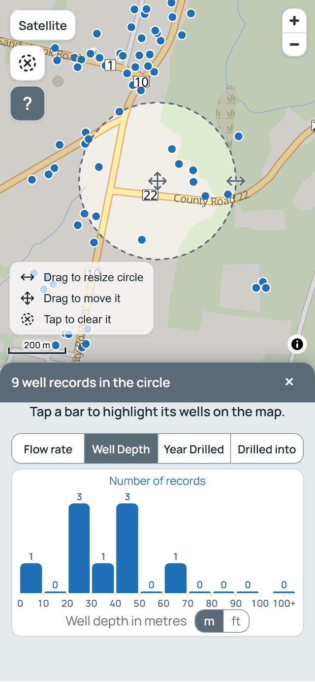
The example: a circle where County Road 10 meets County Road 22. The chart counts 9 well records.
See the wells in one bar
Tap a bar. Its wells turn orange on the map, and the line under the chart names the range. Tap the same bar again to turn them back.
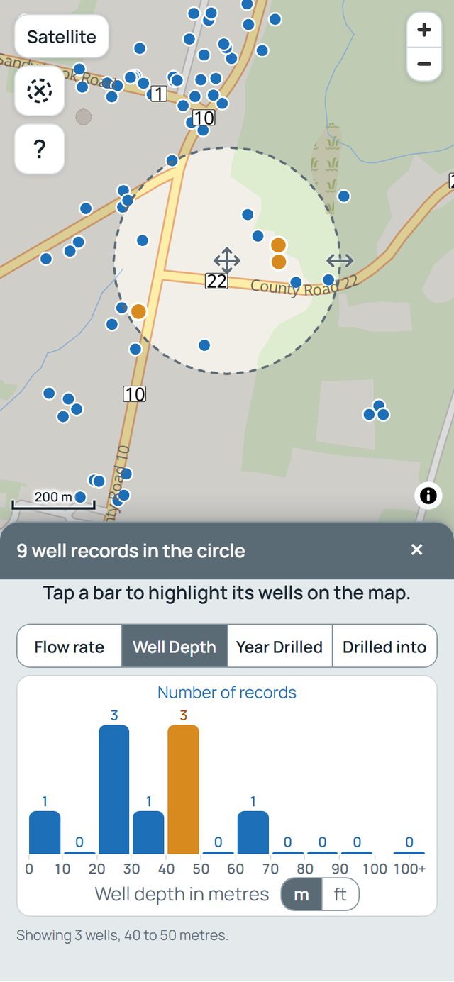
The 40 to 50 metre bar, tapped: its 3 wells turn orange.
Open one well's record
Tap one of the orange wells. Its full record opens. The Well Depth box gives the depth in feet and in metres. Original record (PDF) opens the province's own copy of the paper record.
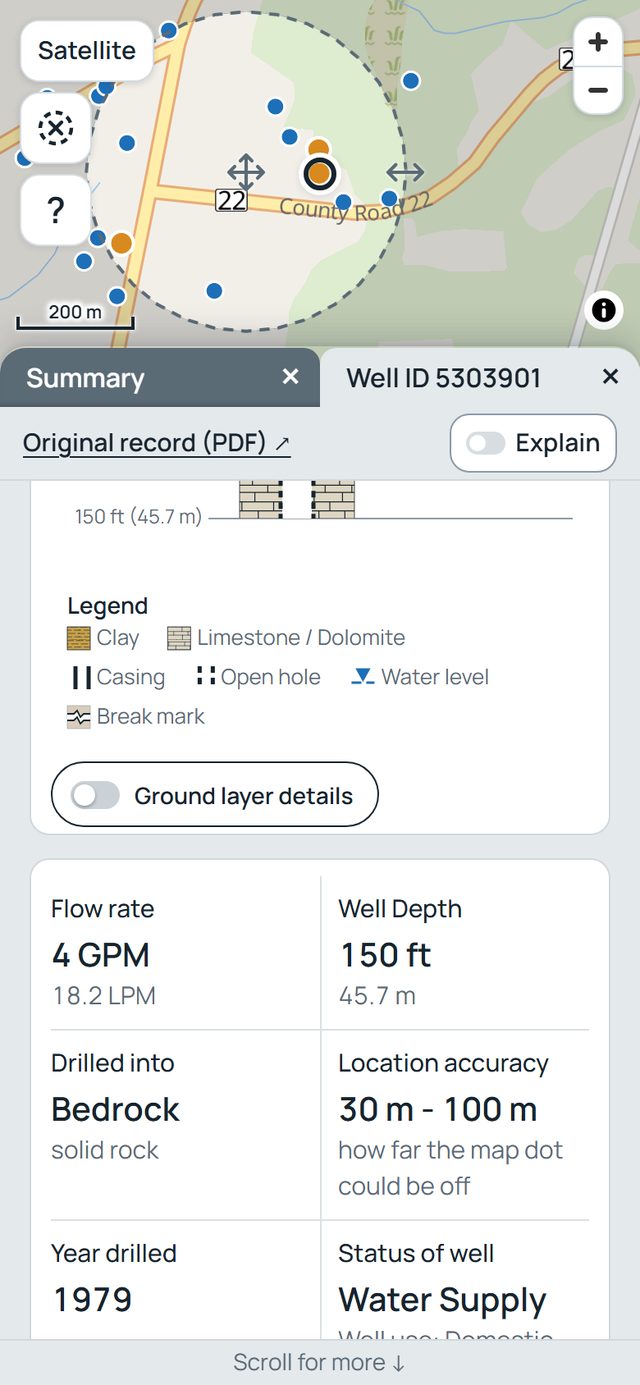
Well 5303901, drilled in 1979: Well Depth 150 ft (45.7 m). Its paper record gives the same 150 feet.
What the depths can and cannot tell you
Each depth comes from one well record, as it was filed. The chart counts records, not the wells in use today: a well may have been deepened, sealed up or replaced since its record was filed. It counts only the records that have a dot on the map, and it does not say how deep a new well on a property would be. A licensed well contractor can look at a particular property.
The Water Wells page explains what a well is and the words a record uses. The Records explains where the records come from and how they are read. Buying a house with a well in Ontario walks through one well's record, line by line.
On the map, tap to place a circle and see a summary of well depths, flow rates and more.